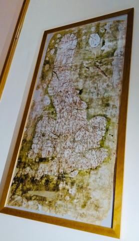
Gough: Wrong Direction
What’s this? Is it:
A work of modern art by Ms Olivia Hippington-Green (she/her), with paint randomly thrown at the canvas, offering a fractured take on modern feminism while demonstrating the artist’s existential grappling with the demands of post-industrial vegan living?
A small child’s attempt to draw a growing carrot? (The colour palette was limited on account of previously careless separation of the paints, resulting in a tertiary browny-green).
An immortalised leakage from under the kitchen sink; a salient reminder to properly maintain one’s plumbing, the towel with which I mopped up the stale sink-water displayed for posterity?
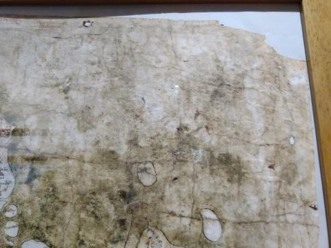
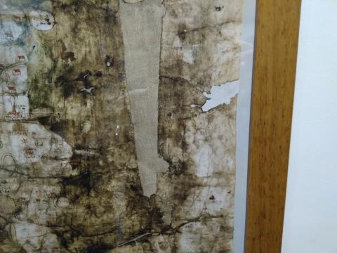
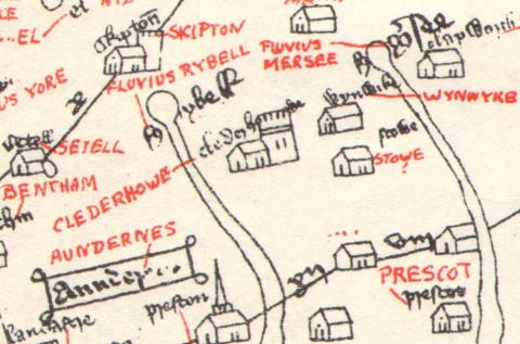
In fact, it’s none of these, but a facsimile of a medieval chart. Called the Gough Map, after a nineteenth-century donor, we know little of its purpose or age. Coventry is depicted with walls, which we know were constructed in 1355 and modern day Queenborough is labelled as Sheppey, the name it had before 1366, so this offers an eleven-year range during which it was probably produced. A Victorian facsimile, available online and with modern place names added in the thirties, shows our own area. Clederhowe (Clitheroe) and Skipton sit not far from the Fluvius Rybell. Settel also features, as does Bentham, bizarrely. The large places of today, such as Blackburn, Burnley and Manchester, elicit no mention, for their days of greatness had not yet come.
Source: Director General of the Ordnance Survey, UK, 31 December 1970
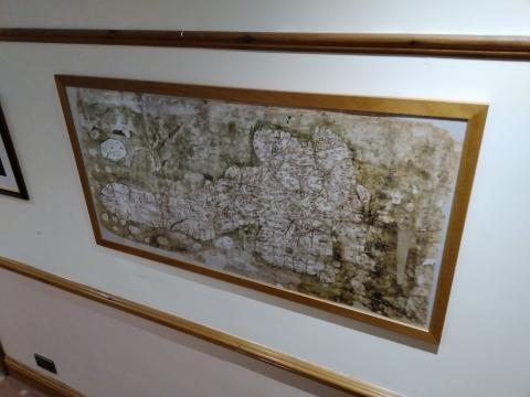
Its mapping purpose is not so immediately obvious because north is on the left, whereas all modern maps have north at the top. This disorientates the modern viewer. When having it framed, I did consider having it hung vertically, so Scotland would be at the top and Lancashire on the left. We tend to see ourselves going ‘up’ to Scotland and ‘across’ to Yorkshire. The place names, however, are written to be read from its current position. Furthermore, I have no wall suitable to host what would have been so tall a picture; my framer said it is the largest item he has ever mounted. As he remarked when he first saw it: “the directions are all wrong”.
I’ve been out on hills before when the fog came down, rendering a map all but useless. What we needed was a compass, to point north, from which we could identify our position and therefore our way down. Indeed, some alarming experiences in the Lake District this year warranted an electronic compass as one of my Christmas gifts from a concerned relative. Without our Creator’s guidance and direction, we go through life disorientated, mistaking north for south, top for bottom, bitter for sweet, goodness for evil.
I will instruct you and teach you in the way you should go; I will guide you with My eye. Ps 32:8 (New King James Version)
- Log in to post comments
 Sunday Worship 10.45am & 6.00pm